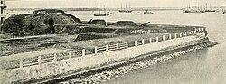
The downtown Charleston waterfront on the Battery
← ホームへ戻る

チャールストン(サウスカロライナ州)歴史と文化が息づく「聖なる街」の魅力

🗓 2026年8月14日

アメリカ合衆国サウスカロライナ州に位置するチャールストンは、1670年の創設以来、350年以上の歴史を刻んできた東海岸の重要都市です。イングランド王チャールズ2世にちなんで名付けられたこの街は、「聖なる街(The Holy City)」や「チャックタウン(Chucktown)」という愛称で親しまれています。ラテン語のモットー「Ædes Mores Juraque Curat(寺院、習慣、そして法を守る)」が示す通り、伝統と法を重んじる気風が今も色濃く残っています。

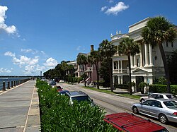
街の景観を象徴するのが、ウォーターフロントに広がる美しい街並みです。特にザ・バッテリー周辺の海岸線は、訪れる人々を魅了して止みません。
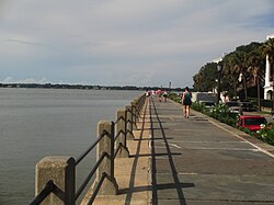
The downtown Charleston waterfront on the Battery

主要な事実(Key Facts)

  • 創設年: 1670年(サウスカロライナ州で最大の人口を誇る都市)
  • 地理的特徴: 海抜わずか0.91メートルという低地であり、水域が市域の約15%を占める
  • 経済の柱: 巨大なチャールストン港、軍事拠点(ジョイントベース・チャールストン)、医療(MUSC)
  • 象徴的建築: レインボーロウやザ・バッテリーなどの歴史的建造物群
  • 気候: 年間降水量が非常に多く、特に夏季に集中する温暖湿潤な気候

歴史の変遷:植民地時代から現代まで

初期の発展と植民地時代

チャールストンは、初期の入植時代から貿易の拠点として発展しました。17世紀末から18世紀にかけて、バーミューダ産の石灰岩を用いて建てられた「ピンクハウス」のような堅牢な建築物が登場し、街の基盤が築かれました。
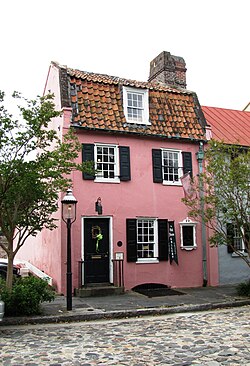
The Pink House, at 17 Chalmers Street, was built of Bermudian limestone between 1694 and 1712 and is the oldest stone building in Charleston.

当時の地理的状況や先住民との関係は、カトバ族の首長が描いた鹿皮の地図などの貴重な史料に残されており、当時の複雑な社会構造を伝えています。

A map of the "Several Nations of Indians to the Northwest of South Carolina" or the "Catawba Deerskin Map", an annotated copy of a hand-painted deerskin original made by a Catawba chief for Governor Francis Nicholson. "This map describing the scituation [sic] of the several nations of Indians to the NW of South Carolina was coppyed [sic] from a draught [sic] drawn & painted on a deer skin by an Indian Cacique and presented to Francis Nicholason Esqr. Governor of South Carolina by whom it is most humbly dedicated to his Royal Highness George, Prince of Wales".

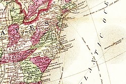
また、バーミューダとの密接な関係は、当時の航路図からも見て取れます。

Map of the Carolinas, Virginia, and Georgia relative to Bermuda

防衛と都市の成長

18世紀半ばには、外敵から街を守るための防衛壁が整備されました。1733年頃の地図には、港湾都市としての機能と軍事的な備えが詳細に記録されています。
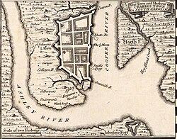
Herman Moll's 1733 Town and Harbour of Charles Town in South Carolina, showing the town's defensive walls.

商業の中心地として栄えたのが、イーストベイ通りに並ぶ色鮮やかな家々「レインボーロウ」です。これらの建物は、植民地時代の商業的な繁栄を象徴しています。
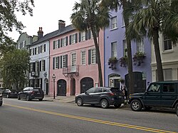
Rainbow Row's 13 houses along East Bay Street formed the commercial center of the town in the colonial period.

革命と南北戦争の激動

アメリカ独立戦争期、チャールストンは戦略的な要衝となり、1780年には激しい攻防戦が繰り広げられました。
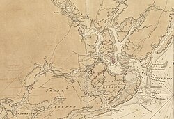
Charlestown and environs in 1780

その後、18世紀末から19世紀にかけては、ジェームズ・ラドソン副知事の邸宅のような豪華な建築物が建てられ、南部特有の富と文化が花開きました。
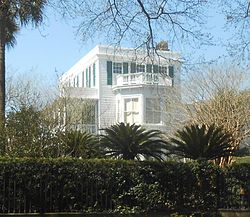
Ladson House, built in 1792 for Lieutenant Governor James Ladson

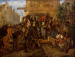
しかし、この繁栄の裏には奴隷貿易という暗い歴史がありました。1859年に建てられた旧奴隷市場博物館や、当時の奴隷売買の記録は、街が過去の過ちを認め、反省するための重要な記憶として保存されています。
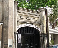
The former German Fire Co. Engine House and Old Slave Mart Museum, at 8 and 6 Chalmers Street, respectively, were built in 1859.
Alonzo J. White selling slaves in Charleston in 1853

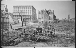
1861年に始まった南北戦争では、チャールストンは激戦地となりました。ザ・バッテリーに設置された巨大なコロンビア砲が街を守りましたが、最終的には激しい火災に見舞われ、街の多くが廃墟となりました。
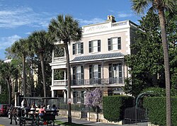
Edmondston-Alston House, built in 1828 on the Battery, showing carriage tour
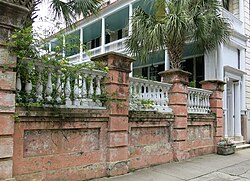
Homes along the Battery
Two 10" Columbiads guarding the Battery in 1863.
The ruins of Charleston in 1865, following major fires in 1861 and at the evacuation of the Confederates

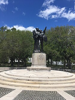
戦後の復興期には、南北戦争による中断を経て1870年にカスタムハウス(税関)が完成するなど、徐々に都市機能が回復していきました。また、サンプター要塞の防衛者を記念する碑などが建てられ、地域の記憶が継承されています。
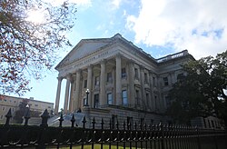
The Charleston Custom House was completed in 1870 after construction was halted in 1859 due to the tensions leading to the Civil War.
The 1932 monument in the Battery memorializing the Confederate defenders of Fort Sumter.

都市の構造と現代のライフスタイル

建築と街並みの美学

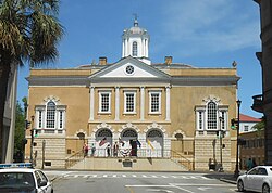
現代のチャールストンは、歴史的な邸宅とモダンな都市機能が共存しています。1808年に建てられたナサニエル・ラッセル・ハウスや、1767年建設の旧取引所(Old Exchange)など、保存状態の良い建築物が点在しています。
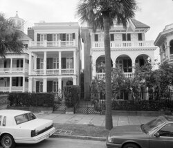
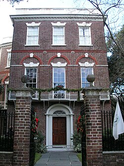
A Charleston street
Nathaniel Russell House, built in 1808
Old Exchange and Provost Dungeon, on Broad Street, built in 1767

また、19世紀後半に建てられたカルフーン・マンションや、18世紀末のポヤス=コーエン・モルデカイ・ハウスなど、多様な時代の建築様式が街の個性を形成しています。
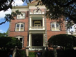
The Calhoun Mansion, at 16 Meeting Street, was built in 1876 by George Williams but derived its name from a later occupant, his grandson-in-law Patrick Calhoun.
The Poyas-Cohen Mordecai House, at 69 Meeting Street, built in 1796–1800

インフラと経済の発展

地理的には、クーパー川とワンド川に挟まれたダニエル島などの居住区が広がっており、複雑な河川系が港湾都市としての利便性を高めています。
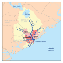
Map showing the major rivers of Charleston and the Charleston Harbor watershed

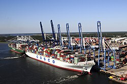
交通の要として、2005年に開通したアーサー・ラベネル・ジュニア橋は、建設当時、西半球で最長の斜張橋として注目を集めました。また、チャールストン港のワンダ・ウェルチ・ターミナルは、東海岸で最も深い水深を誇る港湾施設の一つとして、物流の心臓部を担っています。
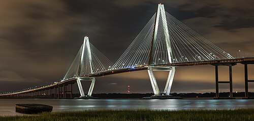
The new Arthur Ravenel Jr. Bridge, constructed in 2005 and named after the late U.S. Representative Arthur Ravenel Jr., who pushed the project to fruition, was at the time of its construction the longest cable-stayed bridge in the Western Hemisphere.
Wanda Welch Terminal in the Port of Charleston

教育と公共施設

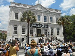
教育面では、チャールストン大学(College of Charleston)のランドルフ・ホールなどの歴史的校舎が、知的な街の雰囲気を醸し出しています。また、市庁舎では無料の歴史ツアーが提供されており、市民や観光客に開かれた行政運営が行われています。
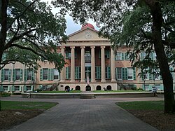
Randolph Hall, College of Charleston
City Hall is open to visitors for free historical tours (shown here during Spoleto Festival USA)

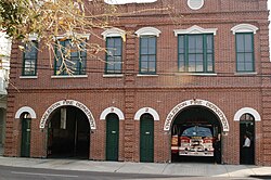
消防署などの公共インフラも整備されており、地域の安全を支えています。

Fire Department station houses for Engines 2 and 3 of the Charleston Fire Department

地理と環境

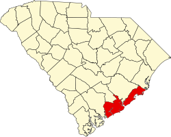
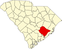
チャールストンは、サウスカロライナ州のチャールストン郡とバークリー郡にまたがっています。非常に低地であるため、自然災害の影響を受けやすく、1989年のハリケーン・ヒューゴーによる甚大な被害などの経験が、現在の防災意識に繋がっています。
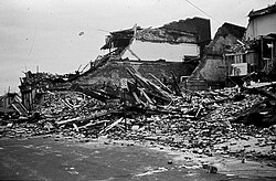
Damage left from Hurricane Hugo in 1989
Map of South Carolina highlighting Berkeley County
Map of South Carolina highlighting Charleston County

気候データ概要

年間を通じて温暖ですが、夏季は非常に高温多湿となり、降水量も増加します。冬は比較的穏やかですが、稀に氷点下まで気温が下がることがあります。

チャールストンの平均気候データ(年平均)
項目 数値(平均) 備考
年平均気温 約19.2°C 夏季は最高36°Cを超える
年間総降水量 1,334 mm 6月〜9月に集中
平均相対湿度 72.7% 年間を通じて高水準
年間日照時間 2,808.8 時間 非常に日照量が多い

経済と産業

現代のチャールストンは、軍事、医療、航空宇宙産業が経済を牽引しています。特にジョイントベース・チャールストンやサウスカロライナ医科大学(MUSC)は、地域最大の雇用主となっています。また、ボーイング社の工場進出により、製造業の活性化も見られます。

スポーツ面では、チャールストン・バッテリー(サッカー)などが活動しており、MUSCヘルス・スタジアムなどの施設が利用されてきました。
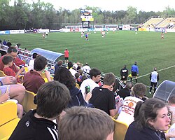
MUSC Health Stadium, home of the Charleston Battery from 1998 until 2019

Frequently Asked Questions

チャールストンが「聖なる街(Holy City)」と呼ばれるのはなぜですか?

街の中に数多くの教会や宗教施設が立ち並び、その尖塔が街のスカイラインを形成していることから、この愛称で呼ばれています。

レインボーロウとはどのような場所ですか?

イーストベイ通りに沿って並ぶ13軒のパステルカラーの家々で、植民地時代の商業中心地として栄えた歴史を持つ、街で最も写真に撮られるスポットの一つです。

この街の主要な産業は何ですか?

軍事(空軍・海軍の共同基地)、高度医療(サウスカロライナ医科大学)、航空宇宙(ボーイング社)、および大規模な港湾物流が主要な産業です。

地理的にどのようなリスクがありますか?

海抜が非常に低いため、洪水やハリケーンの影響を受けやすい傾向にあります。過去にはハリケーン・ヒューゴーなどの大規模な自然災害に見舞われたことがあります。

歴史的に重要な建築物はどこで見られますか?

ザ・バッテリー沿いの邸宅群や、17世紀末のピンクハウス、旧取引所、そして奴隷貿易の歴史を伝える旧奴隷市場博物館などが代表的です。

References

  1. The female figure is sometimes glossed as , although the official explanation is that she is a of Charleston itself. Similarly, although aedes properly refers to temples and originally referred to the churches depicted on the seal, the official gloss is that it intends the city's "buildings".
  2. As defined by the , for use by the for statistical purposes only.
  3. The Brown Fellowship Society, initially a , operated from 1790 to 1945.
  4. , , and , , came closest, reaching 40% at times.
  5. A monument to Vesey as a freedom fighter was long opposed by Charleston's white community but was finally begun in 2010 after a compromise placed it in , out of the historic district and far from the original proposed site in .

📸 フォトギャラリー

The downtown Charleston waterfront on the Battery
The Pink House, at 17 Chalmers Street, was built of Bermudian limestone between 1694 and 1712 and is the oldest stone building in Charleston.
A map of the "Several Nations of Indians to the Northwest of South Carolina" or the "Catawba Deerskin Map", an annotated copy of a hand-painted deerskin original made by a Catawba chief for Governor Francis Nicholson. "This map describing the scituation [sic] of the several nations of Indians to the NW of South Carolina was coppyed [sic] from a draught [sic] drawn & painted on a deer skin by an Indian Cacique and presented to Francis Nicholason Esqr. Governor of South Carolina by whom it is most humbly dedicated to his Royal Highness George, Prince of Wales".
Map of the Carolinas, Virginia, and Georgia relative to Bermuda
Herman Moll's 1733 Town and Harbour of Charles Town in South Carolina, showing the town's defensive walls.
Rainbow Row's 13 houses along East Bay Street formed the commercial center of the town in the colonial period.
Charlestown and environs in 1780
Ladson House, built in 1792 for Lieutenant Governor James Ladson
The former German Fire Co. Engine House and Old Slave Mart Museum, at 8 and 6 Chalmers Street, respectively, were built in 1859.
Edmondston-Alston House, built in 1828 on the Battery, showing carriage tour
Homes along the Battery
The Poyas-Cohen Mordecai House, at 69 Meeting Street, built in 1796–1800
Alonzo J. White selling slaves in Charleston in 1853
Two 10" Columbiads guarding the Battery in 1863.
The ruins of Charleston in 1865, following major fires in 1861 and at the evacuation of the Confederates
The Charleston Custom House was completed in 1870 after construction was halted in 1859 due to the tensions leading to the Civil War.
The 1932 monument in the Battery memorializing the Confederate defenders of Fort Sumter.
A Charleston street
Map showing the major rivers of Charleston and the Charleston Harbor watershed
Damage left from Hurricane Hugo in 1989
The Calhoun Mansion, at 16 Meeting Street, was built in 1876 by George Williams but derived its name from a later occupant, his grandson-in-law Patrick Calhoun.
Nathaniel Russell House, built in 1808
Old Exchange and Provost Dungeon, on Broad Street, built in 1767
MUSC Health Stadium, home of the Charleston Battery from 1998 until 2019
City Hall is open to visitors for free historical tours (shown here during Spoleto Festival USA)
Fire Department station houses for Engines 2 and 3 of the Charleston Fire Department
The new Arthur Ravenel Jr. Bridge, constructed in 2005 and named after the late U.S. Representative Arthur Ravenel Jr., who pushed the project to fruition, was at the time of its construction the longest cable-stayed bridge in the Western Hemisphere.
Wanda Welch Terminal in the Port of Charleston
Randolph Hall, College of Charleston
Map of South Carolina highlighting Berkeley County
Map of South Carolina highlighting Charleston County