British Columbia's geography is epitomized by the variety and intensity of its physical relief, which has defined patterns of settlement and industry since colonization.
← ホームへ戻る

ブリティッシュコロンビア州カナダ西岸の自然と文化が交差する地

🗓 2026年8月10日

カナダの最西端に位置するブリティッシュコロンビア州(BC州)は、険しい山脈と美しい海岸線、そして多様な文化が共存するダイナミックな地域です。太平洋に面したこの州は、豊かな天然資源と近代的な都市機能が融合し、世界中から人々を惹きつけてやみません。

州の地形は極めて多様で、その起伏の激しさが歴史的な定住パターンや産業の発展に大きな影響を与えてきました。
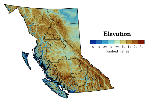
British Columbia's geography is epitomized by the variety and intensity of its physical relief, which has defined patterns of settlement and industry since colonization.

主要な都市の配置を見ると、多くの人口が沿岸部や内陸の主要拠点に集中していることがわかります。
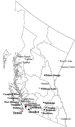
Outline map of British Columbia with significant cities and towns.

Key Facts

  • 州都: ビクトリア
  • 最大都市: バンクーバー
  • 人口: 約500万人(2021年時点)でカナダ第3位
  • 面積: 約94.5万平方キロメートル(カナダ全体の約9.5%)
  • 主要言語: 英語(事実上の公用語)
  • 象徴: パシフィック・ドッグウッド(州花)、ウェスタンレッドシダー(州木)

地理と気候の多様性

BC州の気候は、地域によって劇的に変化します。沿岸部は海洋性気候の影響を受け、冬は穏やかで雨が多く、夏は涼しく過ごしやすいのが特徴です。一方で内陸部へ進むと、より極端な気温差を持つ大陸性気候へと移行します。
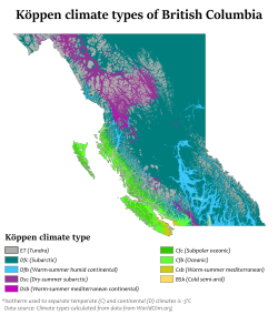
Köppen climate types in British Columbia

特にバンクーバー周辺のジョージア海峡は、州の経済と交通の要所となっています。
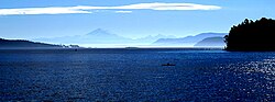
The Strait of Georgia, near Vancouver

内陸部では、シュスワップ湖のような壮大な湖沼地帯が広がり、自然の美しさを際立たせています。
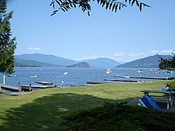
Shuswap Lake as seen from Sorrento

また、オカナガン地域は温暖な気候に恵まれており、高品質なワインを生み出すブドウ園が点在する農業地帯として知られています。
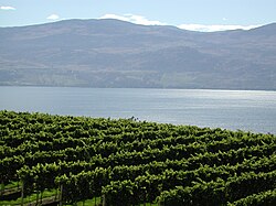
The Okanagan region has a climate suitable for vineyards.

山岳地帯と国立公園

州の東側には世界的に有名なカナディアンロッキーがそびえ立ち、ロブソン山のような最高峰が威容を誇ります。
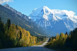
Mount Robson, Canadian Rockies

オダレイ山やオハラ湖などの絶景スポットは、登山客や自然愛好家にとっての聖地です。
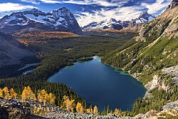
Odaray Mountain and Lake O'Hara

ヨーホー国立公園をはじめとする多くの保護区が設けられており、手つかずの自然が守られています。
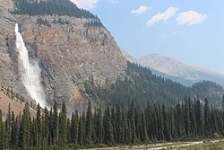
Yoho National Park

さらに、ガリバルディ州立公園のチーカムス湖のように、氷河が作り出した神秘的な風景も随所に見られます。
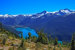
Cheakamus Lake in Garibaldi Provincial Park

豊かな生態系と野生動物

BC州の自然は、多様な動植物の宝庫です。海岸線ではザトウクジラなどの海洋哺乳類が回遊し、豊かな海の世界を形成しています。
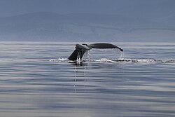
Humpback whale in Sooke coast

陸上では、州の哺乳類シンボルであるケルモードクマ(スピリットベア)や、太平洋サケなどの希少な種が生息しています。環境省は州内を「太平洋海洋」「太平洋海辺」「ボレアル山岳」など6つのエコゾーンに分類し、体系的な保護に取り組んでいます。

歴史と文化的背景

ヨーロッパ人の入植以前から、この地にはファーストネーション(先住民族)が独自の文化を築いていました。彼らが制作した変身マスクや、家屋を飾るトーテムポールは、精神世界と自然への深い敬意を象徴しています。
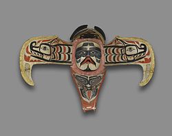
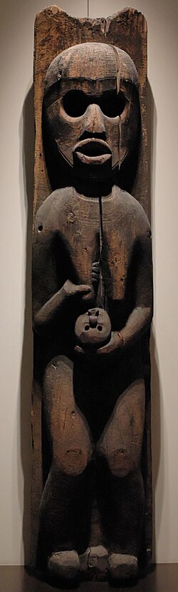
ʼNamgis Thunderbird Transformation Mask, 19th century
Kwakwaka'wakw house pole depicting a woman holding an infant, second half of the 19th century

19世紀に入ると、毛皮貿易やゴールドラッシュをきっかけに植民地化が進みました。1845年に建設されたビクトリア砦などは、当時の入植の拠点となった歴史的建造物です。
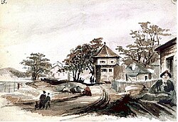
Fort Victoria in 1845
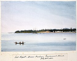
Fort Rupert, Vancouver Island, 1851

初期の入植者たちは、この地の風景をヨーロッパの田園風景になぞらえて捉えていました。
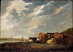
Cattle near the Maas by Dutch painter Aelbert Cuyp. Moody likened his vision of the nascent Colony of British Columbia to the pastoral scenes painted by Cuyp.

1864年頃のビクトリアの街並みは、急速な都市化の始まりを物語っています。
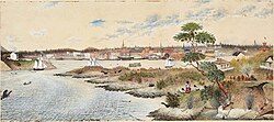
Victoria, 1864

BC州がカナダ連邦に加入する際の重要な条件となったのが、大陸横断鉄道の建設でした。1885年に打ち込まれた「最後のスパイク」は、州の発展を加速させる決定的な出来事となりました。
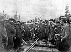
Lord Strathcona drives the Last Spike of the Canadian Pacific Railway, at Craigellachie, November 7, 1885. Completion of the transcontinental railroad was a condition of British Columbia's entry into Confederation.
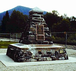
Memorial to the "last spike" in Craigellachie

20世紀に入ると、軍事的な貢献や経済成長を経て、現代の多文化社会へと発展しました。1940年代のニューウェストミンスターでの行軍風景は、当時の社会情勢を今に伝えています。
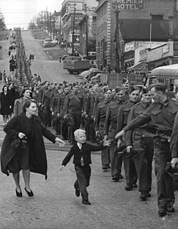
Wait for Me, Daddy, a photo taken by Claude P. Dettloff of the British Columbia Regiment marching in New Westminster, October 1940

また、2010年のバンクーバー冬季オリンピックの開催は、州の国際的なプレゼンスをさらに高める機会となりました。
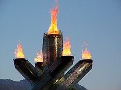
The cauldron of the 2010 Winter Olympics in Vancouver

現代の社会と都市構造

現在のBC州では、人口の多くが南西部の都市圏に集中しています。
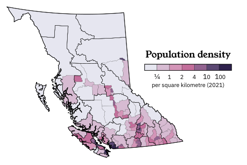
Population density map of British Columbia

最大都市のバンクーバーは、近代的な高層ビルが立ち並ぶスカイラインが特徴的な国際都市です。
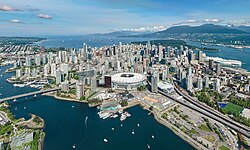
The Vancouver skyline

英語とフランス語の併記された看板が示す通り、カナダの公用語政策が浸透しています。
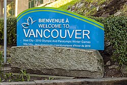
A Vancouver welcome sign in both English and French

ダウンタウンのカナダ・プレイスやテルス・ガーデンのような建築物は、都市の経済的繁栄を象徴しています。
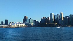
Canada Place in Downtown Vancouver
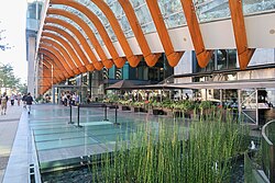
Entrance to Telus Garden

一方、州都ビクトリアにある州議事堂は、伝統的な建築様式を維持し、政治の中心地としての威厳を保っています。
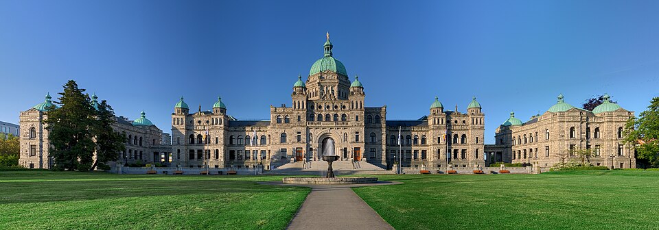
The British Columbia Parliament Buildings in Victoria

政治と行政

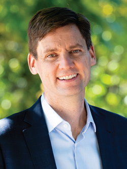
BC州は議会制立憲君主制を採用しており、副総督が君主を代表し、行政の責任者は州首相(現在はデビッド・エビー氏)が務めています。
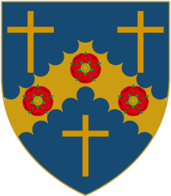
Coat of arms' escutcheon of the current lieutenant governor
David Eby is premier, BC's head of government.

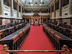
州議会の議場では、地域の未来を決定する重要な議論が行われています。

The meeting chamber of the Legislative Assembly

生活文化とインフラ

BC州の生活は、自然への親しみと都市の利便性が調和しています。パシフィック・ドッグウッドの花は、州の美しさを象徴する存在として親しまれています。
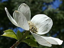
The flower of the Pacific dogwood is often associated with British Columbia.

交通インフラが整備されており、アレックス・フレイザー橋のような大規模な橋梁が都市間の移動を支えています。
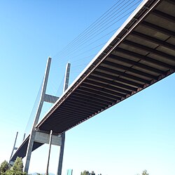
The Alex Fraser Bridge on Highway 91 between Richmond and Delta

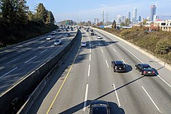
ハイウェイ1号線は、州を横断する主要な動脈として機能しています。

British Columbia Highway 1 near Brentwood, Burnaby

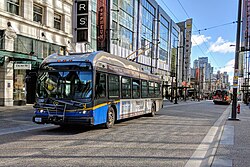
都市部では、スカイトレイン(自動運転鉄道)やトロリーバスなどの効率的な公共交通システムが完備されています。
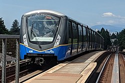
SkyTrain is the rail rapid transit system that serves Metro Vancouver.
Trolley buses in Vancouver

また、カナディアン・パシフィック鉄道(CPR)などの鉄道網は、今なお物流と観光の重要な手段です。
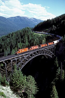
CPR train traversing the Stoney Creek Bridge

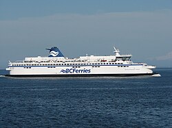
島嶼部への移動には、大型フェリーが欠かせない生活路線となっています。

Spirit of Vancouver Island S-class ferry

芸術と食文化

エミリー・カーのような画家が先住民の文化や風景を描き、地域の芸術性を高めました。
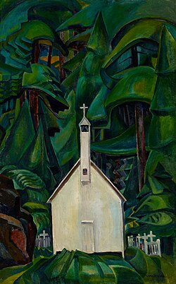
Church at Yuquot Village by Emily Carr (1929)

音楽面では、バンクーバー交響楽団などが質の高い公演を行い、文化的な豊かさを提供しています。
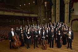
The Vancouver Symphony Orchestra at the Orpheum concert hall (2019)

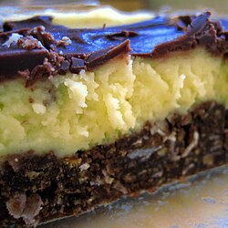
食文化においては、地元の食材を活かした「BCロール(焼き鮭とキュウリの寿司)」や、ナナイモ市発祥のスイーツ「ナナイモバー」が有名です。
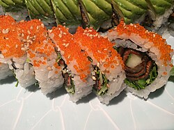
The BC roll is a kind of sushi containing barbecued salmon and cucumber
Nanaimo bars originate from the city of Nanaimo and consist of a crumb and nut base, custard middle, and ganache top layer

レジャーと教育

冬にはウィスラーなどでアイスセーリングなどのウィンタースポーツが盛んです。
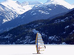
Ice sailing in Whistler

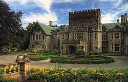
ビクトリアの海岸線沿いのトレイルや、歴史的なハトリー城などの観光スポットも人気を集めています。
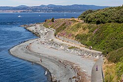
Shoreline Trail in Victoria
Hatley Castle on the campus of Royal Roads University

教育面では、ブリティッシュコロンビア大学(UBC)やサイモンフレーザー大学(SFU)などの世界的な研究機関が揃っています。
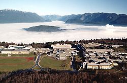
Aerial view of Simon Fraser University in Burnaby

また、クエスト大学のような私立大学も、多様な学びの場を提供しています。

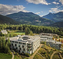
Quest University Canada Academic Building, aerial view

州の概要まとめ

ブリティッシュコロンビア州の基本データ
項目 詳細
人口(2021年) 5,000,879人
GDP(2024年) 約4,290.89億カナダドル
主要都市 バンクーバー、ビクトリア、ケロウナ
主要産業 林業、鉱業、観光業、農業(ワイン等)
HDI (2023年) 0.937(非常に高い)

Frequently Asked Questions

BC州の気候の特徴は何ですか?

沿岸部は温暖で雨が多い海洋性気候ですが、内陸部へ向かうにつれて気温差が激しくなる大陸性気候へと変化します。特にオカナガン地域は温暖でブドウ栽培に適しています。

州内で最も人口が多い都市はどこですか?

バンクーバーが最大都市であり、グレーターバンクーバー圏としてカナダでも有数の人口密度を誇る都市圏を形成しています。

BC州の象徴的な食べ物はありますか?

ナナイモ市発祥の「ナナイモバー」というスイーツや、地元の焼き鮭を使用した「BCロール」という寿司が代表的です。

州内の主要な教育機関は?

ブリティッシュコロンビア大学(UBC)やサイモンフレーザー大学(SFU)、ビクトリア大学などの公立大学に加え、多くの専門大学や私立大学が存在します。

先住民族の文化はどのように受け継がれていますか?

トーテムポールや伝統的なマスクなどの芸術作品を通じて、彼らの精神的な歴史や自然との共生思想が現代に伝えられています。

References

  1. According to the Oxford Guide to Canadian English Usage ( ; p. 335), BCer(s) is an informal demonym that is sometimes used for residents of BC
  2. Commonly abbreviated as BC; : Colombie-Britannique
  3. Statistics represent both single (for example, "German") and multiple (for example, "Chinese-English") responses to the 2016 census and thus do not add up to 100 percent. All items are self-identified.
  4. Statistic includes all persons that did not make up part of a visible minority or an indigenous identity.

📸 フォトギャラリー

British Columbia's geography is epitomized by the variety and intensity of its physical relief, which has defined patterns of settlement and industry since colonization.
Outline map of British Columbia with significant cities and towns.
Köppen climate types in British Columbia
The Strait of Georgia, near Vancouver
Shuswap Lake as seen from Sorrento
The Okanagan region has a climate suitable for vineyards.
Mount Robson, Canadian Rockies
Odaray Mountain and Lake O'Hara
Yoho National Park
Cheakamus Lake in Garibaldi Provincial Park
Humpback whale in Sooke coast
ʼNamgis Thunderbird Transformation Mask, 19th century
Kwakwaka'wakw house pole depicting a woman holding an infant, second half of the 19th century
Fort Victoria in 1845
Fort Rupert, Vancouver Island, 1851
Cattle near the Maas by Dutch painter Aelbert Cuyp. Moody likened his vision of the nascent Colony of British Columbia to the pastoral scenes painted by Cuyp.
Victoria, 1864
Lord Strathcona drives the Last Spike of the Canadian Pacific Railway, at Craigellachie, November 7, 1885. Completion of the transcontinental railroad was a condition of British Columbia's entry into Confederation.
Memorial to the "last spike" in Craigellachie
Wait for Me, Daddy, a photo taken by Claude P. Dettloff of the British Columbia Regiment marching in New Westminster, October 1940
The cauldron of the 2010 Winter Olympics in Vancouver
Population density map of British Columbia
The Vancouver skyline
A Vancouver welcome sign in both English and French
Canada Place in Downtown Vancouver
Entrance to Telus Garden
The British Columbia Parliament Buildings in Victoria
Coat of arms' escutcheon of the current lieutenant governor
David Eby is premier, BC's head of government.
The meeting chamber of the Legislative Assembly
The flower of the Pacific dogwood is often associated with British Columbia.
The Alex Fraser Bridge on Highway 91 between Richmond and Delta
British Columbia Highway 1 near Brentwood, Burnaby
SkyTrain is the rail rapid transit system that serves Metro Vancouver.
Trolley buses in Vancouver
CPR train traversing the Stoney Creek Bridge
Spirit of Vancouver Island S-class ferry
Church at Yuquot Village by Emily Carr (1929)
The Vancouver Symphony Orchestra at the Orpheum concert hall (2019)
The BC roll is a kind of sushi containing barbecued salmon and cucumber
Nanaimo bars originate from the city of Nanaimo and consist of a crumb and nut base, custard middle, and ganache top layer
Ice sailing in Whistler
Shoreline Trail in Victoria
Hatley Castle on the campus of Royal Roads University
Aerial view of Simon Fraser University in Burnaby
Quest University Canada Academic Building, aerial view