私たちが地図上で目にする「国境」は、単なる線ではありません。それは海洋や山脈といった自然の造形によってもたらされる地理的境界であると同時に、政府や主権国家などの政治主体によって設定される政治的境界でもあります。国境は、戦争や植民地化、あるいは国家間の合意を通じて形成され、人、動物、物資の移動を制御する重要な役割を担っています。
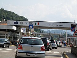
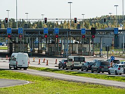
現代において、国境は必ずしも物理的な壁を意味しません。シェンゲン協定加盟国間のように完全に開放された国境もあれば、厳格な検問所を通じてのみ通過が許される管理された国境もあります。また、空港や港湾も、法的な意味での「国境」として機能しています。

Key Facts
- 国境は自然地形(山・川など)によるものと、政治的合意や線引きによるものに大別される。
- 幾何学的境界は、経緯線などの直線を用いて設定され、旧植民地地域に多く見られる。
- 非武装地帯(DMZ)は、軍事活動を禁止することで緊張緩和や野生動物の保護区として機能する場合がある。
- 領空の垂直的な境界は国際的に厳格に定められていないが、一般的に高度100kmのカーマンラインが宇宙空間との境界とされる。
- 国境は経済的な関税徴収の拠点となる一方、自由貿易の進展によりその重要性が低下する傾向もある。
国境の分類と形成プロセス
自然国境と景観境界
地形的な特徴を利用した国境は「自然国境」と呼ばれます。広大な湖や深い森林、険しい山脈などがこれに当たり、物理的な障壁として機能します。
幾何学的境界と人為的線引き
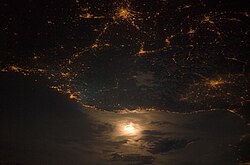
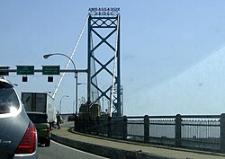
地形に関係なく、経度や緯度などの直線や弧を用いて設定されるのが「幾何学的境界」です。この形式は、北米、アフリカ、中東などの旧植民地領土から発展した国家に多く見られます。例えば、アメリカとカナダの国境は、北緯49度線に沿って約3,500kmにわたり直線的に伸びています。
遺構としての国境(レリック・ボーダー)
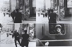
かつては法的な境界であったが、現在はその役割を終えたものを「遺構国境」と呼びます。物理的な境界線は消えても、景観や文化、経済的な差異としてその痕跡が残る場合があります。かつての東西ドイツ国境がその典型例であり、現在は統合されていますが、歴史的な指標が今も風景の中に残っています。
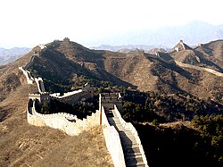
また、中国の万里の長城のように、かつては軍事的な防衛線として機能していたものの、現在は歴史的遺構となった例もあります。
空間的な境界:領海と領空
国境は地上の線だけではありません。海上の境界である領海や、その上空に広がる領空も主権の範囲に含まれます。国際法に基づき、各国は自国の領空を規制し保護する権利を持っています。
領空の水平的な範囲は、一般的に海岸線から12海里までとされています。一方、垂直的な境界については、高度約100kmにある「カーマンライン」が、地球の大気圏(領空)と宇宙空間を分ける基準として広く認識されています。

国境管理と特殊な区域
非武装地帯(DMZ)の機能
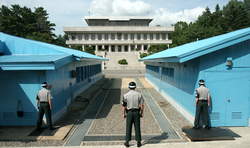
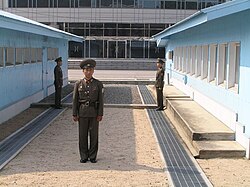
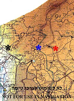
対立する国家や集団の間で、軍事活動を禁止することに合意した区域を非武装地帯(DMZ)と呼びます。ここは停戦線や緩衝地帯として機能しますが、皮肉にも人間の立ち入りが制限されるため、絶滅危惧種などが生息する貴重な自然保護区となることがあります。朝鮮半島の軍事境界線はその代表例です。
国境の規制レベル
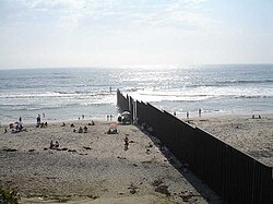
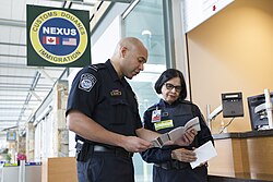
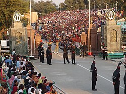
国境の管理状況は多岐にわたります。厳格な管理が行われる国境では、壁の建設や武装警備員による監視が行われます。一方で、経済的な統合が進んだ地域では、国境の障壁を取り除くことで自由貿易や通勤を促進する「ユーロリージョン」のような仕組みが導入されています。

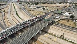
また、国境付近での共同作業や協力体制を構築するケースもあり、治安維持のために隣接国同士が連携して警備にあたる場面も見られます。
国境がもたらす経済的・政治的影響
国家は関税の徴収や外貨獲得のため、国境での貿易を規制します。しかし、公式なルート以外での「非公式貿易」が盛んな地域もあり、例えばアフリカの角(Horn of Africa)では、家畜の取引が公式統計を大幅に上回る規模で行われていると推定されています。
政治的には、国境は合意によって決められるだけでなく、一方的な押し付けや第三者(国際会議など)による決定、あるいは旧宗主国からの継承によって形成されます。こうした経緯が、後の国境紛争の火種となることも少なくありません。
近年では、グローバル化による「国境なき世界」という言説に対し、あえて国境の重要性を再考する「国境研究」が盛んになっています。また、国境地帯での社会政治的な経験を表現する「ボーダー・アート」という芸術形式も登場しています。

| 分類 | 定義・特徴 | 具体例 |
|---|---|---|
| 自然国境 | 山脈、河川、湖などの自然地形を利用 | アルプス山脈(仏伊国境) |
| 幾何学的境界 | 経緯線などの直線的な線引き | 北緯49度線(米加国境) |
| 遺構国境 | 法的な効力は失ったが、痕跡が残る境界 | 旧東西ドイツ国境 |
| 非武装地帯 | 軍事活動が禁止された緩衝区域 | 朝鮮半島軍事境界線 |
Frequently Asked Questions
国境とフロンティア(辺境)の違いは何ですか?
「国境(Border)」は国家間の境界線そのものを指しますが、「フロンティア(Frontier)」はその境界線周辺に広がる地域や領域のことを指します。
領空の高さに上限はあるのでしょうか?
国際的に厳格な法的合意があるわけではありませんが、一般的に高度100kmの「カーマンライン」が、大気圏(領空)と宇宙空間の境界線として認められています。
非武装地帯(DMZ)が自然保護区になるのはなぜですか?
軍事的な緊張から人間の立ち入りが厳しく制限されるため、結果として人間による開発や干渉を受けず、野生動物が繁殖しやすい環境が維持されるためです。
幾何学的境界はなぜ多く存在するのですか?
主に植民地時代に、現地の地形や文化的な境界を無視して、宗主国が地図上で直線的に領土を分割して決定した歴史的背景があるためです。
国境が経済に与える影響にはどのようなものがありますか?
関税による国家収入の確保という側面がある一方で、国境の障壁は貿易のコストを上げます。そのため、EUのように国境管理を緩和して自由貿易を促進する動きがあります。
References
- (2016). "The Rise and Spread of Capitalism". In Daniels, Peter; ; Shaw, Denis; Sidaway, James; Hall, Tim (eds.). An Introduction To Human Geography (5th ed.). . p. 47. .
- Fehlen, Fernand [in Luxembourgish] (2017). "Mental Barriers Replacing Nation-State Borders". In Andrén, Mats; Lindkvist, Thomas; Söhrman, Ingmar [in Swedish]; (eds.). Cultural Borders of Europe: Narratives, Concepts and Practices in the Present and the Past. . p. 122. .
- Jones, T. (2010). Outlaw in Medieval Literature. Springer. p. 51. – via .
- Robinson, Edward Heath (2012). "Reexamining Fiat, Bona Fide and Force Dynamic Boundaries for Geopolitical Entities and their Placement in DOLCE" (PDF). . 7: 93–108. :10.3233/AO-2012-0103. Archived from the original (PDF) on 30 December 2013.
- Miles, William F. S. (2014). Scars of Partition: Postcolonial Legacies in French and British Borderlands. U of Nebraska Press. p. 3. .
Anglo-French carving of colonial space is a significant geographical legacy: nearly 40 percent of the entire length of today's international boundaries were traced by Britain and France.
- Chen, Yuan Julian (July 2018). "Frontier, Fortification, and Forestation: Defensive Woodland on the Song–Liao Border in the Long Eleventh Century". . 2 (2): 313–334. :10.1017/jch.2018.7. 2059-1632.
- Winterhalter, Elizabeth (2018-10-20). "Why Are U.S. Borders Straight Lines?". JSTOR Daily. Retrieved 2023-01-05.
- Smith, Barry (1995). "On Drawing Lines on a Map". In Frank, A. U.; Kuhn, W.; Mark, D. M. (eds.). Spatial Information Theory. Proceedings of COSIT 1995. Berlin/Heidelberg/Vienna/New York/London/Tokyo: . pp. 475–484. Archived from the original on 2019-02-09. Retrieved 2017-01-03.
- "The Constitution of the Republic of Somaliland" (PDF). . 1 May 2001. Archived from the original (PDF) on 27 February 2012. Retrieved 2 February 2010.
- "Simla Agreement". Stimson Center. Archived from the original on 15 February 2019. Retrieved 24 July 2018.
📸 フォトギャラリー