雪崩とは、山や丘などの斜面を雪が急速に流れ落ちる現象です。積雪量の増加や雪層の弱体化といった自然要因で自発的に発生することもあれば、人間や動物の進入、あるいは地震などの外部刺激が引き金となることもあります。大規模な雪崩は単なる雪の移動に留まらず、氷や岩石、樹木までも巻き込みながら猛烈な勢いで加速します。
Key Facts
- 発生要因:降雪による荷重増加、積雪内部の弱層形成、外部からの衝撃(人間・地震など)。
- 危険な斜面:特に35度から45度の斜面で人間が誘発する雪崩が多く、臨界角は38度とされる。
- 主要な種類:固まった雪の層が崩れる「スラブ雪崩」と、不安定な雪が点から広がる「面雪崩(ルース雪崩)」がある。
- 破壊力:パウダー雪崩は時速300kmを超えることがあり、湿った雪崩は低速ながら巨大な質量で地形を削り取る。
- 生存リスク:埋没による窒息、外傷、低体温症が主な死因となる。
雪崩の主要な種類と特性
スラブ雪崩と面雪崩
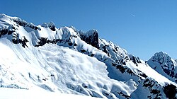
雪崩は大きく分けて2つの形態に分類されます。一つは、密に詰まった雪の層が下層の弱層(不安定な層)の崩壊によって一気に滑り出すスラブ雪崩です。もう一つは、比較的緩い雪が局所的に崩れ始める面雪崩(ルース雪崩)です。これらが組み合わさって発生する場合もあります。
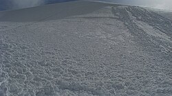
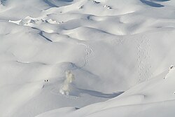
特にスラブ雪崩では、雪面が割れて大きな塊として滑落するため、非常に危険です。例えば、スノーボーダーなどの荷重が引き金となり、比較的浅い積雪層であっても広範囲にわたる崩落を招くことがあります。
パウダー雪崩(粉雪雪崩)
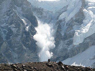
大規模な雪崩が激しく加速すると、雪が空気と混ざり合い、乱流状の懸濁流となるパウダー雪崩へと発展します。これは重力流の一種であり、上部に巨大な粉雪の雲を伴います。時速300kmを超える速度に達することがあり、質量は100万トンに及ぶこともあります。その威力は凄まじく、平坦な谷底を長距離移動したり、短距離であれば上り斜面を駆け上がることさえあります。
湿った雪崩(ウェットスノーアバランシェ)
冬の終わりや気温が上昇する時期に多く見られるのが、水分を多く含んだ湿った雪崩です。これは雪と水が混ざり合った状態で、摩擦が大きいため移動速度は時速10〜40kmと低速です。しかし、密度と質量が極めて高いため、破壊力は非常に強く、巨石や樹木をなぎ倒し、地面を深く削り取るほどの威力を持っています。
雪崩の発生経路と地形的要因
雪崩が辿るルート
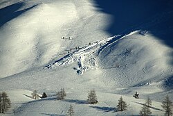
雪崩は地形の急峻さと雪量に応じて特定の経路を辿ります。一般的に、30〜45度の斜面にある出撃点(Starting Point)から始まり、20〜30度の走行路(Track)を通り、傾斜が20度未満になった堆積域(Runout Zone)で停止します。ただし、積雪の状態や誘発要因によってこれらの角度は変動します。
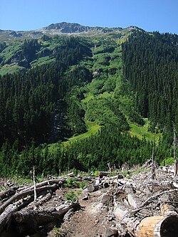
危険な地形と積雪構造
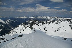
統計的に、25度未満の緩斜面や60度を超える急斜面では雪崩の発生頻度は低くなります。一方で、スキーが可能な程度の傾斜を持つ斜面は、常に雪崩の潜在的なリスクを孕んでいます。また、稜線(リッジ)を移動することは、斜面を横切るよりも一般的に安全とされています。
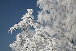
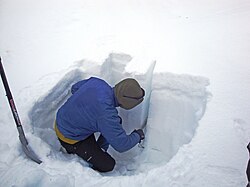
積雪内部の構造も重要です。例えば、表面に形成された霜(地表霜)が後の降雪で埋もれると、それが滑りやすい「弱層」となり、上層の雪が滑り落ちる原因となります。専門家は雪坑を掘り、層の剥離しやすさを確認することで積雪の安定性を評価します。
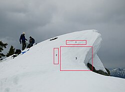
また、山の頂上付近に形成される雪庇(せっぴ)の崩落が、下方の斜面で大規模な雪崩を誘発するケースも多く見られます。
リスク管理と被害軽減策
予測と警告システム
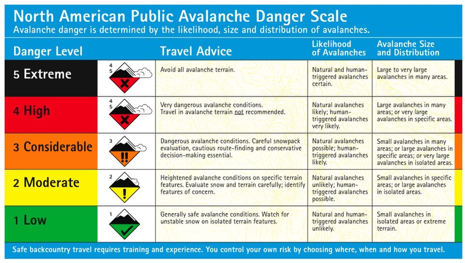
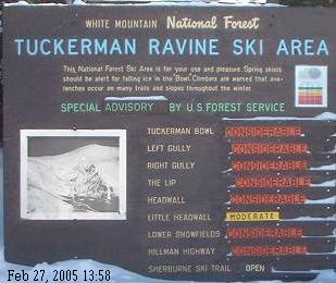
雪崩の被害を防ぐため、多くの地域で危険度レベル(1〜5段階)による予報が提供されています。また、レーダーによる監視や、危険箇所での人工的な爆破による強制的な雪崩誘発(アバランシェ・ブラスティング)などの対策が講じられています。
![Radar station for avalanche monitoring in Zermatt.[37]](/images/48/93/4893139939e03faf96d323e39136107829617a2ae4ab0027bd4703cf3a2bb2cd.jpg)
物理的な防止策
道路や集落を守るため、雪の堆積を防ぐ雪柵(スノーフェンス)の設置や、警告看板の設置などのハード面での対策が行われています。
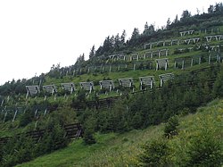
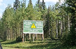
事故の傾向と生存戦略
レクリエーション目的の山行における雪崩事故の多く(ある研究では約83%)は、当事者自身の行動によって誘発されています。対して、居住区や産業施設での事故は自然発生的なものがほとんどです。生存率を高めるには、地形の判断能力を養い、適切な救助装備を携行することが不可欠です。
雪崩の規模と危険度まとめ
| 規模区分 | 物理的特徴 | 想定される破壊力・影響 |
|---|---|---|
| 小規模 (Small/Sluff) | 長さ100m未満 / 体積1,000m³未満 | 人体への影響は限定的だが、埋没の危険あり |
| 中規模 (Medium) | 長さ1,000m未満 / 体積10,000m³未満 | 乗用車を破壊し、数本の樹木を折る威力 |
| 大規模 (Large) | 長さ1,000m超 / 体積10,000m³超 | 大型トラックや建物を破壊し、森林をなぎ倒す |
| 最大規模 (Major) | 極めて膨大な質量と流動距離 | 地形そのものを変貌させるほどの壊滅的な威力 |
Frequently Asked Questions
大きな声や音で雪崩は起きるのか?
いいえ、叫び声や大きな音でスラブ雪崩が誘発されるというのは迷信です。音による圧力波は、雪層を崩壊させるために必要なエネルギーよりも桁違いに小さいため、現実的なトリガーにはなりません。
どのような斜面が最も危険か?
一般的に35度から45度の斜面が最も危険とされており、特に38度が人間による誘発が最も起きやすい「臨界角」とされています。ただし、スキーやスノーボードができる程度の傾斜があれば、どこでも発生する可能性があります。
パウダー雪崩と湿った雪崩の違いは何か?
パウダー雪崩は乾燥した雪が空気と混ざり、時速300kmを超える超高速で移動する乱流です。一方、湿った雪崩は水を含んだ重い雪が低速(時速10〜40km)で移動しますが、その巨大な質量によって地形を削り取るほどの強い破壊力を持ちます。
雪崩に巻き込まれた時の主な死因は?
主な死因は、雪に埋まったことによる窒息、激しい衝撃による外傷、および極低温環境下での低体温症の3点です。
気候変動は雪崩にどのような影響を与えるか?
気温上昇に伴い、冬の終わりの温暖化による「湿った雪崩」の増加や、降雪パターンの変化による積雪構造の不安定化が懸念されています。
References
- ↑ "Snow Avalanches | National Snow and Ice Data Center". nsidc.org. Retrieved 23 March 2021.
- ↑ Louchet, Francois (2021). Snow Avalanches. Oxford University Press. pp. 1–2. doi:10.1093/oso/9780198866930.001.0001. ISBN 978-0-19-886693-0.
- ↑ Reuter, B.; Schweizer, J. (2009). Avalanche triggering by sound: Myth and truth (PDF). ISSW 09 – International Snow Science Workshop, Proceedings. pp. 330–333.
Based on order of magnitude estimates of the pressure amplitude of various sources that cause elastic or pressure (sound) waves it can be ruled out that shouting or loud noise can trigger snow slab avalanches. The amplitudes are at least about two orders of magnitude smaller than known efficient triggers. Triggering by sound really is a myth.
- 1 2 3 4 McClung, David and Shaerer, Peter: The Avalanche Handbook, The Mountaineers: 2006. ISBN 978-0-89886-809-8
- ↑ Bartelt, Perry; Lehning, Michael (24 May 2002). "A physical SNOWPACK model for the Swiss avalanche warning Part I: Numerical model". Cold Regions Science and Technology. 35 (3): 123–145. Bibcode:2002CRST...35..123B. doi:10.1016/S0165-232X(02)00074-5 – via www.mendeley.com.
{{cite journal}}: CS1 maint: deprecated archival service (link) - 1 2 "Avalanches: Their Dangers and How to Reduce Your Risks". www.wunderground.com. Retrieved 15 April 2024.
- ↑ Simpson JE. 1997. Gravity currents in the environment and the laboratory. Cambridge University Press
- ↑ "Avalanche". education.nationalgeographic.org. Retrieved 10 April 2024.
- ↑ Daffern, Tony: Avalanche Safety for Skiers, Climbers and Snowboarders, Rocky Mountain Books: 1999. ISBN 0-921102-72-0
- ↑ Abbott, Patrick (2016). Natural Disasters. New York: McGraw-Hill Education. ISBN 978-0-07-802298-2.
📸 フォトギャラリー