地球上の5つの海洋の中で、最も小さく、かつ最も浅いのが北極海です。この海域は、その極端な低温と広大な海氷によって知られており、地理学的には大西洋の河口のような役割を果たしているとも言われています。国際水路機関(IHO)によって正式な海洋として定義されていますが、その閉鎖的な構造から「北極地中海」や「北極海」とも呼ばれます。
北極海は、地球全体の海洋システムにおける最北端の構成要素であり、その環境は地球全体の気候調節において極めて重要な役割を担っています。
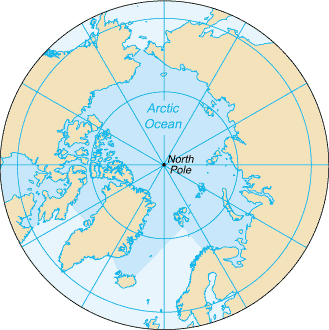
主要な事実(Key Facts)
- 面積: 約1,406万平方キロメートルで、世界最小の海洋。
- 平均水深: 1,038メートル。
- 最深点: フラム海峡にあるモロイホール(約5,550メートル)。
- 特徴: 5大洋の中で最も水温が低く、季節的に広大な海氷に覆われる。
- 地理的規模: 面積は南極大陸に匹敵するが、ロシアの国土面積よりは小さい。
地理的構造と海底地形
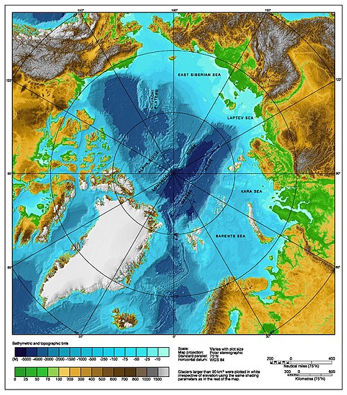
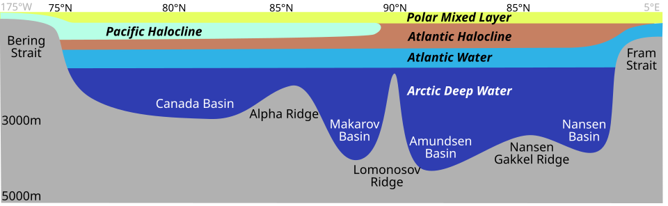
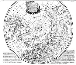
北極海はほぼ円形の盆地状の構造をしており、海岸線の総延長は約45,390キロメートルに及びます。海底地形において特筆すべきはロモノソフ海嶺という巨大な海底山脈で、これが北極盆地を「ユーラシア盆地」と「アメリシア盆地(北米盆地)」の2つに分断しています。
ユーラシア盆地およびアメリシア盆地は、ともに水深4,000メートル前後の深海域となっており、その周囲には広大な大陸棚が広がっています。
周辺海域と接続ルート
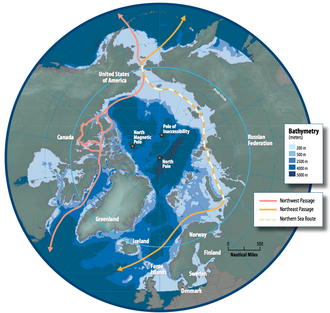
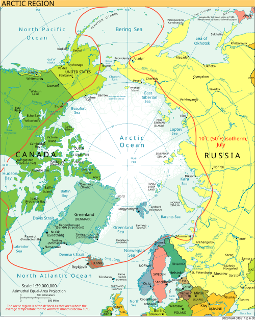
北極海には多くの周辺海(縁海)が存在し、それぞれが独自の特性を持っています。最大規模のバレンツ海をはじめ、ハドソン湾、グリーンランド海、東シベリア海、カラ海、ラプテフ海、チュクチ海、ボーフォート海などが含まれます。
また、この海域は戦略的な航路としても注目されており、ロシア沿岸を通る北東航路(およびその一部である北極海航路)や、カナダ諸島を抜ける北西航路が存在します。
海洋物理学と気候のメカニズム
北極海の水温と塩分濃度は、複雑な層状構造(成層)を形成しています。海水は淡水とは異なり、凝固点に近づくにつれて密度が増し、沈降する性質があります。海氷が形成されるには、海面から100〜150メートルまでの水層が凝固点まで冷却される必要があります。
冬の間、氷の下にある比較的暖かい海水が断熱材のような役割を果たすため、北極圏の気温は南極大陸ほどの極端な低温にはなりにくいという特徴があります。
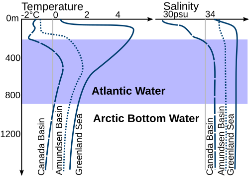
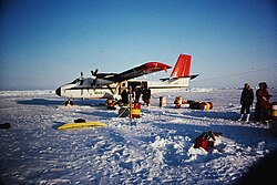
海氷の範囲は季節によって大きく変動し、1年のうち約10ヶ月間は氷の上に雪が積もります。特に3月から4月にかけて積雪が最大となり、氷上の雪深は20〜50センチメートルに達します。
![Sea cover in the Arctic Ocean, showing the median, 2005 and 2007 coverage[85]](/images/16/6b/166becafd8d861ee16a79d66dcdbdb66f574ef0b6eb6a0d6cc050902c9f1b2db.jpg)
生態系と生物多様性
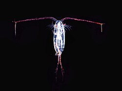
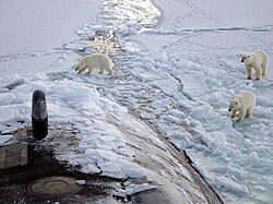
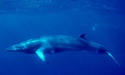
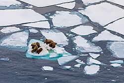
極限の寒冷環境である北極海ですが、独自の生態系が構築されています。食物連鎖の基礎となるカイアシ類などの動物プランクトンから、ホッキョクグマ、セイウチ、ミンククジラといった大型の海洋哺乳類まで、多様な生物が適応して生存しています。
経済的境界と主要拠点
北極海を囲む国々は、国連海洋法条約に基づき排他的経済水域(EEZ)を設定しています。ロシア、カナダ、アメリカ、ノルウェー、デンマーク(グリーンランド)などが、資源開発や環境保護の観点からこの海域の管理権を主張しています。
また、厳しい環境下ながら、ロシアのムルマンスクやアルハンゲリスク、ノルウェーのロングイヤービエン、カナダのチャーチルなど、物流や研究の拠点となる港湾都市が点在しています。
北極海に関する概要まとめ
| 項目 | 詳細内容 |
|---|---|
| 総面積 | 約14,056,000 km² |
| 平均水深 | 1,038 m |
| 最深部 | モロイホール(約5,550 m) |
| 主要な海嶺 | ロモノソフ海嶺 |
| 主要な周辺海 | バレンツ海、カラ海、チュクチ海など |
| 主要航路 | 北東航路、北西航路 |
Frequently Asked Questions
北極海は他の海洋と比べて何が特殊なのですか?
世界で最も小さく浅い海洋であること、そして年間を通じて極めて低い水温を維持し、広大な海氷に覆われている点が最大の特徴です。また、陸地に囲まれた盆地状の構造をしているため、大西洋の延長線上にある「巨大な河口」のような性質を持っています。
北極海の海底にはどのような地形がありますか?
ロモノソフ海嶺という巨大な海底山脈が中央を走っており、これにより海盆がユーラシア盆地とアメリシア盆地の2つに分かれています。また、深い海溝や平坦な深海平原、断層による海嶺などが複雑に分布しています。
海氷はどのようにして形成されるのでしょうか?
海面付近(上層100〜150メートル)の水温が凝固点まで低下することで形成されます。海水は凝固点付近で密度が高くなるため、冷えた水が沈み込み、その上の層がさらに冷やされるというプロセスを経て氷が成長します。
北極海に面している主な国はどこですか?
主にロシア、カナダ、アメリカ(アラスカ州)、ノルウェー、およびデンマーク(グリーンランド)の5カ国が北極海に沿岸を持っており、それぞれが排他的経済水域(EEZ)を管理しています。
References
- Pidwirny, Michael (2006). "Introduction to the Oceans". physicalgeography.net. Archived from the original on 9 December 2006. Retrieved 7 December 2006.
- General oceanography: an introduction (2nd ed.). New York: Wiley. 1980. p. 501. . 6200221.
- "Chart of the North Polar Sea". collections.lib.uwm.edu. Retrieved 12 November 2025.
- Tomczak, Matthias; Godfrey, J. Stuart (2003). Regional Oceanography: an Introduction (2nd ed.). Delhi: Daya Publishing House. . Archived from the original on 30 June 2007. Retrieved 22 April 2006.
- "'Arctic Ocean' – Encyclopædia Britannica". Encyclopedia Britannica. Retrieved 2 July 2012.
As an approximation, the Arctic Ocean may be regarded as an estuary of the Atlantic Ocean.
- Some Thoughts on the Freezing and Melting of Sea Ice and Their Effects on the Ocean Archived 8 November 2017 at the K. Aagaard and R. A. Woodgate, Polar Science Center, Applied Physics Laboratory University of Washington, January 2001. Retrieved 7 December 2006.
- "Arctic Sea Ice News and Analysis | Sea ice data updated daily with one-day lag". Retrieved 1 September 2020.
- "Climate Change: Arctic sea ice summer minimum | NOAA Climate.gov". www.climate.gov. 18 October 2022. Retrieved 8 January 2026.
- "Understanding the Arctic sea ice: Polar Portal". polarportal.dk. Retrieved 1 September 2020.
- Goebel T, Waters MR, O'Rourke DH (2008). "The Late Pleistocene Dispersal of Modern Humans in the Americas" (PDF). Science. 319 (5869): 1497–502. :2008Sci...319.1497G. 10.1.1.398.9315. :10.1126/science.1153569. 18339930. 36149744.
{{}}: Cite uses deprecated parameter|citeseerx=()
📸 フォトギャラリー