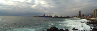
チリ北部の海岸線に位置するアントファガスタは、「北の真珠(La perla del Norte)」という愛称で親しまれる重要な港湾都市です。首都サンティアゴから北に約1,100km離れたこの街は、アタカマ砂漠の厳しい自然環境の中にありながら、世界的な鉱業拠点としてチリの経済を支える中枢機能を担っています。
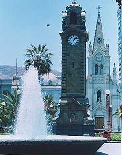
主要な事実(Key Facts)
- 人口規模: 2024年時点で約40万人を数え、チリで5番目に大きな都市である。
- 経済的地位: 銅およびリチウム鉱業の主要サービス拠点であり、一人当たりGDPが非常に高い。
- 気候的特徴: 年間平均降水量が極めて少なく、「世界で最も乾燥した街」の一つとされる。
- 地理的象徴: 市街地の北側を南回帰線が通過しており、記念碑が設置されている。
歴史的背景と領土の変遷
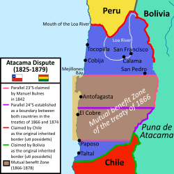
アントファガスタの歴史は、19世紀半ばの硝石(チリ硝石)採掘の発見から始まりました。1868年にホセ・サントス・オッサらによって入植が始まった当初、この地域はボリビアの領有下にありました。しかし、鉱物資源を巡る税制上の対立や、ボリビアとペルーの秘密同盟などが複雑に絡み合い、緊張が高まりました。
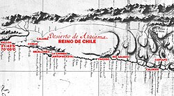
1879年2月14日、チリ軍がアントファガスタを占領したことで、いわゆる太平洋戦争(1879年〜1883年)が勃発しました。この紛争の結果、チリは同地域への主権を確立し、1904年の平和友好条約によってボリビアとの国境が確定しました。
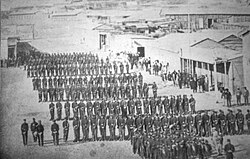
20世紀に入ると、都市は急速に近代化し、商業と工業の中心地へと発展しました。一方で、自然災害の脅威にもさらされており、1991年の大規模な土石流や1995年のマグニチュード7.3の地震など、厳しい自然環境との共生を余儀なくされてきました。
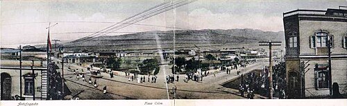
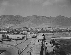
地理と極限の気候
標高約40mの沿岸平野に位置するアントファガスタは、世界的に有名なアタカマ砂漠に隣接しています。この地域の最大の特徴は、その極端な乾燥にあります。年間の平均降水量はわずか数ミリメートルであり、市街地においてはほぼゼロに近い年もあり、地球上で最も雨が降らない都市の一つとして知られています。
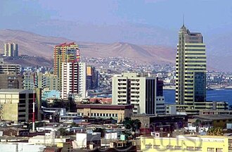
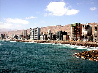
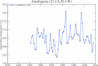
気温は年間を通じて穏やかで、年平均気温は約16.8℃です。しかし、稀に発生する豪雨は、乾燥した地質と相まって深刻な土石流や地滑りを引き起こすリスクを孕んでいます。
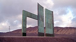
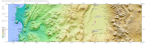
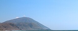
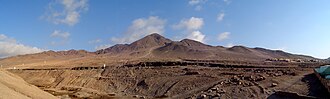
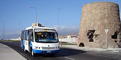
また、都市の北側には南回帰線が通り、2000年には太陽暦としても機能する記念碑が建設されました。周囲は険しい地形に囲まれており、セロ・コロソなどの山々が街の景観を形作っています。
経済の柱:鉱業と物流
アントファガスタの経済は、一貫して鉱業に深く依存しています。かつては銀や硝石が中心でしたが、19世紀半ば以降は銅が主役になり、2010年代以降は次世代エネルギーに不可欠なリチウムの輸送・サービス拠点としての重要性が増しています。チリは世界最大級のリチウム埋蔵量を誇り、その輸出の多くがこの街の港を経由します。
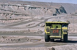
また、世界最大級の銅鉱業見本市「Exponor」が開催されるなど、ビジネス観光の拠点としても機能しており、世界中の鉱山関係者が集まります。こうした産業構造により、2012年時点ではチリ国内で最高の一人当たりGDPを記録するなど、極めて高い経済水準を維持しています。
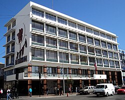
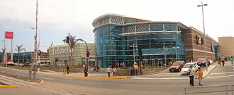
多文化社会と都市インフラ
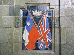
経済的な繁栄は多様な移民を惹きつけました。特にイギリス系住民のコミュニティが大きく、街にはその歴史を物語る記念碑が残っています。また、日本人による日本庭園が整備されるなど、多文化共生が進んでいる点も特徴です。
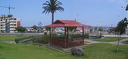
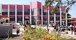
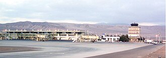
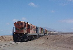
交通インフラとしては、パンアメリカンハイウェイの一部であるルート5-CHが主要幹線となっており、空路ではアンドレス・サベジャ・ガルベス国際空港が、海路では大規模な港湾施設が機能しています。特に鉄道(FCAB)は、1888年の設立以来、鉱物資源をボリビアやアルゼンチンへと結ぶ重要な物流ルートとして生き残っています。
アントファガスタの概要まとめ
| 項目 | 詳細内容 |
|---|---|
| 人口 (2024年) | 401,096人(チリ第5位) |
| 主要産業 | 銅・リチウム鉱業、港湾物流 |
| 気候区分 | BWk(冷涼砂漠気候) |
| 年間平均気温 | 16.8 °C |
| 特筆事項 | 世界で最も乾燥した都市の一つ |
Frequently Asked Questions
アントファガスタはどのような街ですか?
チリ北部に位置する港湾都市で、世界的な銅およびリチウム鉱業のサービス拠点です。経済的に非常に豊かであり、「北の真珠」と呼ばれています。
なぜ「世界で最も乾燥した街」と言われるのですか?
アタカマ砂漠という地球上で最も乾燥した地域に位置しているためです。市街地の年間平均降水量は0.1mm未満という極めて低い数値を記録しています。
この街の歴史における重要な出来事は何ですか?
1879年のチリによる占領が太平洋戦争の引き金となったことです。これにより、かつてボリビア領だったこの地域はチリの主権下に入りました。
主要な産業は何ですか?
鉱業が圧倒的な柱です。特に銅の輸出拠点としての役割に加え、近年では電気自動車などのバッテリーに不可欠なリチウムの物流ハブとして重要性を増しています。
観光や文化的な見どころはありますか?
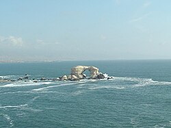
自然記念物の「ラ・ポルターダ(La Portada)」や、南回帰線の記念碑、また多文化的な背景を示す日本庭園やイギリス系コミュニティの記念碑などが挙げられます。
References
- "Municipality of Antofagasta" (in Spanish). Archived from the original on 20 August 2010. Retrieved 6 September 2010.
- "División Político Administrativa y censal, 2007" [Political, Administrative and Census Division, 2007] (PDF) (in Spanish). . Archived from the original (PDF) on 14 November 2010. Retrieved 30 December 2010.
- "Resultados – Censo 2024" [Results – 2024 Census] (in Spanish). .
- "TelluBase—Chile Fact Sheet (Tellusant Public Service Series)" (PDF). Tellusant. Retrieved 11 January 2024.
- Caballo, José (2022). "Reserves, resources and lithium exploration in the salt flats of northern Chile". . 49 (2): 297–306. Retrieved 2 July 2022.
The level of lithium reserves and resources identified and the encouraging expectations for exploration place Chile as a relevant player in the development of the lithium industry worldwide.
- Cambero, Fabian (22 August 2024). "Lithium mining is slowly sinking Chile's Atacama salt flat, study shows". Reuters. Retrieved 25 September 2024.
the area [of subsidence] measures approximately 8 kms (5 miles) north to south and 5 kms (3 miles) east to west. … Chile, the world's second-largest lithium producer, extracts the lightweight metal from the Atacama salt flat, which has one of the largest lithium reserves in the world.
- Economía y Negocios (ed.). "Antofagasta GDP per capita is similar to the UK, and GDP per capita from La Araucanía is similar to Ecuador". Archived from the original on 4 February 2014. Retrieved 17 January 2013.
- Adelaar, Willem F. H.; Muysken, Pieter C. (10 June 2004). The Languages of the Andes (1 ed.). Cambridge University Press. :10.1017/cbo9780511486852.005. .
- Jaime Eyzaguirre (1967). BREVE HISTORIA DE LAS FRONTERAS DE CHILE.
- Patricio Valdivieso (June 2004). "International Relations. Relations of Chile-Bolivia-Perú: War of the Pacific" (PDF). Archived from the original (PDF) on 18 November 2006. Retrieved 31 January 2007.
📸 フォトギャラリー