The tent city (called "The White City" in the handwritten caption) in Ship Creek, photographed by Alberta Pyatt on July 1, 1915.
← ホームへ戻る

アンカレッジアラスカ最大の都市が誇る自然と都市の調和

🗓 2026年8月15日

アラスカ州の経済と文化の中心地であるアンカレッジは、雄大な自然と近代的な都市機能が共存するユニークな街です。「光と花の街」という愛称を持つこの都市は、クック湾の奥深くに位置し、訪れる人々を圧倒する景観と豊かな野生動物との出会いを提供しています。

主要な事実(Key Facts)

  • 州内最大の都市: アラスカ州で最も人口が多く、全米でも74位の規模を誇ります。
  • 地理的特徴: クック湾の河口付近、シップクリークの停泊地に由来して名付けられました。
  • 多様な文化: 非ヒスパニック系白人のほか、アジア系、アラスカ先住民、ヒスパニック系など多様なルーツを持つ人々が暮らしています。
  • 経済規模: 2023年のGDPは約300億ドルに達し、一人当たりGDPは10万ドルを超えています。
  • 自然との共生: 市街地のすぐそばにチュガチ山脈がそびえ、ムースなどの野生動物が日常的に出没します。

都市の成り立ちと歴史的変遷

アンカレッジの歴史は1914年に始まりました。当初はテントが立ち並ぶ簡易的な集落でしたが、1920年に市として法人化され、その後急速に発展しました。1964年にはボロウ(郡)となり、1975年には市と郡が統合された統一自治体となりました。

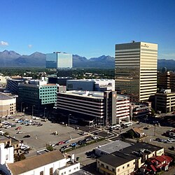
かつての工業地帯は、時代の流れとともに商業エリアへと姿を変え、現在はアラスカで最も高い建物であるコノコフィリップス・ビルディングを含む近代的なスカイラインを形成しています。
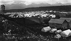
The tent city (called "The White City" in the handwritten caption) in Ship Creek, photographed by Alberta Pyatt on July 1, 1915.
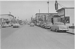
Fourth Avenue in 1953, looking east from near I Street. Just ten years before, the retail area shown in the foreground was mostly an industrial area, housing lumber yards and similar uses.
Downtown Anchorage from Hotel Captain Cook. The gold building on the right, the Conoco-Phillips Building, is the tallest building in Alaska.

しかし、この街は自然の猛威とも向き合ってきました。特に1964年の聖金曜日(グッドフライデー)に発生した大地震は、街の景観に甚大な影響を与えましたが、それを乗り越えて現在の強固な都市基盤が築かれました。
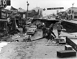
Fourth Avenue after the Good Friday or Great Alaskan earthquake on March 27, 1964

地理と都市構造

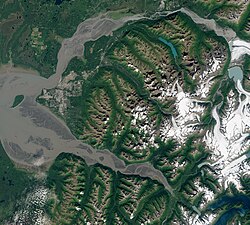
アンカレッジは、北のクニック川から南のターナゲイン湾まで広がる広大なエリアを管轄しています。市街地はクック湾の沿岸にある沖積平野に位置しており、背後には険しいチュガチ山脈が広がっています。
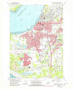
Map of Anchorage in 1979
Satellite view taken August 2020. The Municipality encompasses the entire land mass between the Knik River and Knik Arm (top), and the Turnagain Arm (bottom), with the Mat-Su borough to the north, the Kenai Peninsula to the south, and Whittier just east of the mountains (lower right). The city proper lies on the coastal alluvial plain at the headwaters of Cook Inlet, between the two arms (left of center).
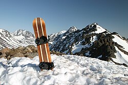
Peak Three in the Chugach Mountains

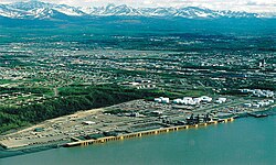
都市のインフラは非常に充実しており、テッド・スティーブンス・アンカレッジ国際空港やアンカレッジ港などの交通拠点、そして州内最高峰の教育機関であるアラスカ大学アンカレッジ校などが集結しています。
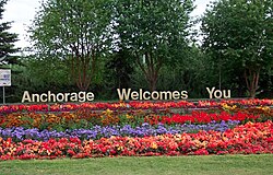
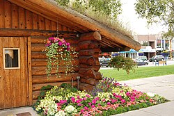
The "Anchorage Welcomes You" sign outside Ted Stevens Anchorage International Airport. The city is known for showcasing abundant flowers during the summer months.
Aerial view of the Port of Anchorage on Cook Inlet in 1999
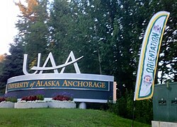
University of Alaska Anchorage entrance sign

気候と自然環境

気候区分では亜寒帯湿潤気候(Dfc)に属し、四季がはっきりしています。夏は比較的温暖で、街中に色鮮やかな花々が咲き誇りますが、冬は厳しく、特に11月には記録的な降雪が見られることもあります。

特筆すべきは、都市部においても野生動物との距離が非常に近いことです。教会や公園などでムースの親子に出会うことは珍しくなく、住民にとって自然は生活の一部となっています。
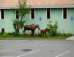
Moose and calf outside a church in Anchorage
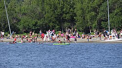
An early summer day at Jewel Lake Park in western Anchorage, Alaska
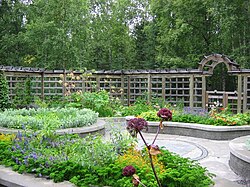
Alaska Botanical Garden

文化・レクリエーションと生活

アンカレッジでは、芸術と自然の両方を楽しむことができます。ラスムソンセンターにあるアンカレッジ博物館やアラスカ芸術センターなどの文化施設が充実している一方で、トニー・ノウルズ・コースタル・トレイルのような屋外レクリエーション施設も人気です。
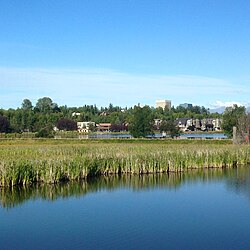
View from the Tony Knowles Coastal Trail near the mouth of Chester Creek. From foreground to background: Westchester Lagoon, the southern reaches of the Bootleggers Cove neighborhood, and the downtown skyline.
The Anchorage Visitor Information Center, downtown on 4th Avenue
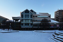
The Alaska Center for the Performing Arts, in downtown Anchorage
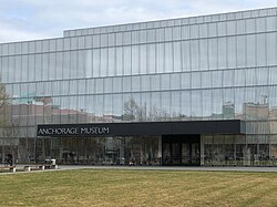
The front entrance of the Anchorage Museum at Rasmuson Center in downtown

また、スポーツ面では野球のアンカレッジ・グレイシャー・パイロッツや、ホッケーのアンカレッジ・ウルヴァリンズなどが地域を盛り上げています。市民の憩いの場として、ゴルフコースやドッグパーク、広大な州立公園などが整備されています。
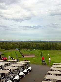
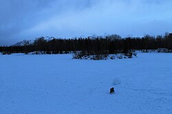
Anchorage Golf Course
University Lake Dog Park, January 2019

行政面では、アンカレッジ市議会と市長による統治が行われており、消防署などの公共サービスが迅速な対応体制を整えています。
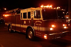
Anchorage Fire Department engine based at its downtown station, responding to a call early in the morning
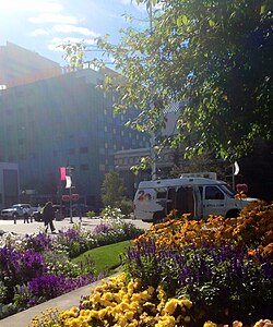
KTUU news van parked at Town Square Park
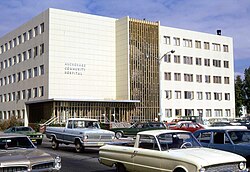
Anchorage Community Hospital as it appeared in August 1972. The building is called the Arne Beltz Building and houses the municipal health department.

アンカレッジの基本データまとめ

アンカレッジ市 概要一覧
項目 詳細内容
人口(2020年) 291,247人
総面積 約1,946.68平方マイル
主要産業・経済 GDP 約300億ドル(2023年)
気候区分 亜寒帯湿潤気候 (Dfc)
主要施設 テッド・スティーブンス国際空港、アラスカ大学アンカレッジ校
姉妹都市(日本) 千歳市

人口統計と多様性

2020年の国勢調査によると、人口構成は多様化が進んでいます。非ヒスパニック系白人が54.33%と過半数を占めますが、アジア系(9.37%)やヒスパニック系(9.08%)、アラスカ先住民(7.72%)などの割合が増加しており、多文化共生社会を形成しています。
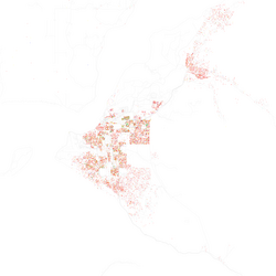
Map of racial/ethnic distribution in Anchorage, 2010 U.S. Census. Each dot is 25 people: Non-Hispanic White, Black, Asian, Hispanic or Alaska Native and Other (yellow)

Frequently Asked Questions

アンカレッジの気候は一年を通してどのような感じですか?

夏は温暖で花が咲き誇り、最高気温が20度を超える日もあります。一方、冬は非常に寒く、特に11月頃に激しい降雪があるのが特徴です。年間を通じて降水量は中程度ですが、冬の積雪量は多くなります。

街の中で野生動物に遭遇することはありますか?

はい、非常に一般的です。特にムースが市街地や公園、住宅街に現れることが多く、住民や観光客にとって日常的な光景となっています。

アンカレッジの経済的な特徴は何ですか?

アラスカ州最大の経済拠点であり、一人当たりのGDPが10万ドルを超えるなど、非常に高い経済水準にあります。交通の要衝としての機能や、州政府・教育機関が集積していることが要因です。

観光客におすすめのスポットはどこですか?

文化的な体験ならアンカレッジ博物館やアラスカ先住民ヘリテージセンターがおすすめです。自然を満喫したい場合は、トニー・ノウルズ・コースタル・トレイルでの散策や、チュガチ山脈へのハイキングが人気です。

アンカレッジの人口構成にはどのような特徴がありますか?

白人が多数派ですが、フィリピン系を含むアジア系や、メキシコ系を中心としたヒスパニック系、そしてアラスカ先住民など、多様な人種・民族が共生している国際的な都市です。

References

  1. In an average winter, the first snow happens in mid-October and begins to thaw in mid-March, but snow can sometimes be present until the end of April. The high temperature would usually drop below freezing at the beginning of November. The average first frost happens during the first half of September and the average last frost happens during the second half of May. In March 2002, a record snow storm, 26.7 inches, hit Anchorage."Temperature Records for Anchorage Alaska" (PDF). . Archived from the original (PDF) on February 20, 2013. Retrieved April 1, 2012.
  2. Includes of murder and nonnegligent manslaughter, forcible rape, robbery, and aggravated assault.
  3. Includes burglary, larceny-theft, motor vehicle theft, and arson.

📸 フォトギャラリー

The tent city (called "The White City" in the handwritten caption) in Ship Creek, photographed by Alberta Pyatt on July 1, 1915.
Fourth Avenue in 1953, looking east from near I Street. Just ten years before, the retail area shown in the foreground was mostly an industrial area, housing lumber yards and similar uses.
Fourth Avenue after the Good Friday or Great Alaskan earthquake on March 27, 1964
Map of Anchorage in 1979
Satellite view taken August 2020. The Municipality encompasses the entire land mass between the Knik River and Knik Arm (top), and the Turnagain Arm (bottom), with the Mat-Su borough to the north, the Kenai Peninsula to the south, and Whittier just east of the mountains (lower right). The city proper lies on the coastal alluvial plain at the headwaters of Cook Inlet, between the two arms (left of center).
Moose and calf outside a church in Anchorage
An early summer day at Jewel Lake Park in western Anchorage, Alaska
Map of racial/ethnic distribution in Anchorage, 2010 U.S. Census. Each dot is 25 people: Non-Hispanic White, Black, Asian, Hispanic or Alaska Native and Other (yellow)
The "Anchorage Welcomes You" sign outside Ted Stevens Anchorage International Airport. The city is known for showcasing abundant flowers during the summer months.
View from the Tony Knowles Coastal Trail near the mouth of Chester Creek. From foreground to background: Westchester Lagoon, the southern reaches of the Bootleggers Cove neighborhood, and the downtown skyline.
The Anchorage Visitor Information Center, downtown on 4th Avenue
Aerial view of the Port of Anchorage on Cook Inlet in 1999
Downtown Anchorage from Hotel Captain Cook. The gold building on the right, the Conoco-Phillips Building, is the tallest building in Alaska.
The Alaska Center for the Performing Arts, in downtown Anchorage
The front entrance of the Anchorage Museum at Rasmuson Center in downtown
Anchorage Golf Course
Peak Three in the Chugach Mountains
Alaska Botanical Garden
Anchorage Fire Department engine based at its downtown station, responding to a call early in the morning
University of Alaska Anchorage entrance sign
University Lake Dog Park, January 2019
KTUU news van parked at Town Square Park
Anchorage Community Hospital as it appeared in August 1972. The building is called the Arne Beltz Building and houses the municipal health department.