The Russian settlement of St. Paul's Harbor, present-day Kodiak town, Kodiak Island, 1814
← ホームへ戻る
アラスカ州アメリカ合衆国アンカレッジデナリアラスカ歴史

アラスカ州の全貌:大自然と歴史が交錯する「最後の手つかずの辺境」

🗓 2026年8月10日

アメリカ合衆国の北西端に位置するアラスカ州は、「最後の手つかずの辺境(The Last Frontier)」という愛称にふさわしく、圧倒的なスケールの自然と独自の文化を持つ地域です。広大な大地には、北米最高峰の山々から氷河、深い森までが広がり、厳しい気候の中で生きる人々が独自のコミュニティを築いています。

主要な事実(Key Facts)

  • 全米最大の面積:アメリカの50州の中で最も広く、2位以下に圧倒的な差をつけています。
  • 人口密度が極めて低い:広大な面積に対し人口は少なく、全米で最も人口密度が低い州です。
  • 多様な民族構成:白人に加え、イヌピアックやユピックなどのアラスカ先住民が重要な役割を担っています。
  • 資源大国:石油や天然ガス、金、そして豊かな漁業資源が経済の柱となっています。
  • 極端な気候:北極圏に位置するため、地域によって激しい寒暖差と極夜・白夜が存在します。

地理的特徴と主要都市

アラスカ州の地理は、その巨大さゆえに非常に多様です。州全体では、北米で最も高い標高を誇るデナリ山(6,190.5m)が象徴的な存在となっています。
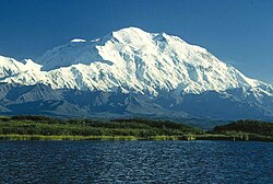
Denali is the highest peak in North America.

州の面積は、他の隣接する州と比較しても桁違いの大きさであり、その広大さがそのまま州のアイデンティティとなっています。
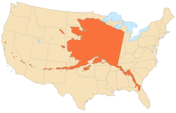
Alaska's size compared with the contiguous states(Albers equal-area conic projection)

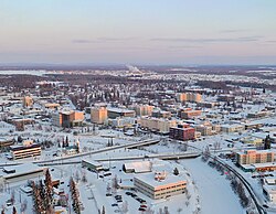
行政上の中心地である州都ジュノーは、道路ではアクセスできず船や飛行機でしか到達できない特殊な立地にあります。一方、経済と人口の中心はアンカレッジであり、州内最大の都市として機能しています。また、内陸部最大の都市フェアバンクスや、北極圏に位置するユトキャヴィク(旧バロウ)など、それぞれの地域で役割の異なる都市が点在しています。
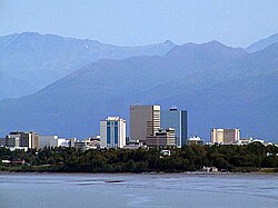
Anchorage is Alaska's largest city.
Fairbanks, Alaska's second-largest city and by a significant margin the largest city in Alaska's interior
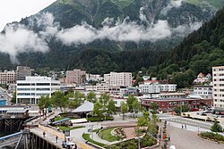
Juneau, Alaska's third-largest city and its capital
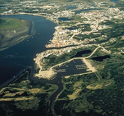
Bethel, the largest city in the Unorganized Borough and in rural Alaska
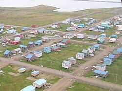
Utqiaġvik (Browerville neighborhood near Eben Hopson Middle School shown), known colloquially for many years by the nickname "Top of the World", is the northernmost city in the United States.

沿岸部にはホーマーやコルドバのような漁業の町があり、自然と共生する生活様式が維持されています。
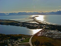
Homer, showing (from bottom to top) the edge of downtown, its airport and the Spit
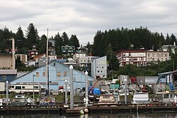
Cordova, built in the early 20th century to support the Kennecott Mines and the Copper River and Northwestern Railway, has been preserved as a fishing community since their closure.

また、内陸のタルキートナのような小さなコミュニティも、観光や登山の中継地として知られています。
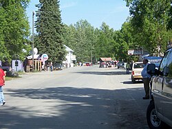
Main Street in Talkeetna

アラスカの土地所有の特徴として、連邦政府が所有する公有地が全米のどの州よりも多いことが挙げられます。

Alaska has more acreage of public land owned by the federal government than any other state.[63]

地理的な特異点として、アリューシャン列島は日付変更線をまたいでおり、アメリカ合衆国の最東端と最西端の両方を同時に含んでいるという珍しい構造を持っています。
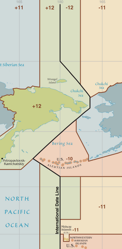
Although entirely east of the International Date Line (the triangular kink in the line was agreed upon the U.S. acquisition of Alaska), the Aleutian Islands cross the 180th meridian, such that they contain both the westernmost (Amatignak) and the easternmost (Semisopochnoi.) points in the United States.

歴史の変遷:ロシア領からアメリカの州へ

アラスカの歴史は、先住民の時代から始まり、その後ロシアによる植民地化が進みました。19世紀初頭にはコディアック島などにロシア人の集落が形成されていました。
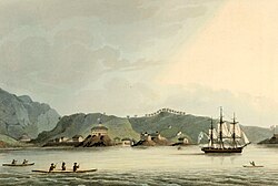
The Russian settlement of St. Paul's Harbor, present-day Kodiak town, Kodiak Island, 1814

その後、1867年にアメリカ合衆国がロシアからアラスカを購入し、「アラスカ条約」が締結されたことで、アメリカの領土となりました。
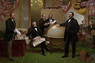
Signing of the Alaska Treaty (1867)

19世紀末には、ゴールドラッシュによる金鉱掘りの人々が押し寄せ、チルクート・トレイルなどの険しい道を越えて多くの人々が流入しました。
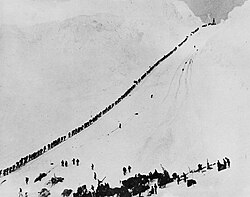
Miners and prospectors climb the Chilkoot Trail during the 1898 Klondike Gold Rush.

第二次世界大戦中には、アッツ島などで激しい戦闘が行われるなど、戦略的な要衝としての側面も持ちました。
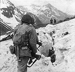
U.S. troops navigate snow and ice during the Battle of Attu in May 1943.

長い領土時代を経て、1959年1月3日にアメリカ合衆国の49番目の州として正式に昇格しました。
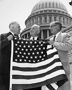
Bob Bartlett and Ernest Gruening, Alaska's inaugural U.S. Senators, hold the 49-star U.S. Flag after the admission of Alaska as the 49th state.

経済と産業の構造

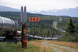
アラスカの経済を語る上で欠かせないのがエネルギー産業です。特に北斜面(ノーススロープ)のプルドーベイ油田は世界的に有名であり、そこからヴァルデーズまで石油を運ぶアラスカ送油管(TAPS)は、永久凍土の融解を防ぐための特殊な設計がなされています。
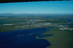
An aerial view of infrastructure at the Prudhoe Bay Oil Field
The Trans-Alaska Pipeline transports oil, Alaska's most financially important export, from the North Slope to Valdez. The heat pipes in the column mounts are pertinent, since they disperse heat upwards and prevent melting of permafrost.

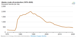
しかし、石油の埋蔵量および生産量はピーク時(1973年および1988年)から大幅に減少傾向にあります。
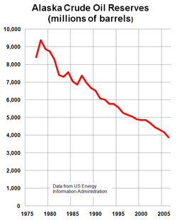
Alaska proven oil reserves peaked in 1973 and have declined more than 60% since then.
Alaskan oil production peaked in 1988 and has declined more than 75% since then.

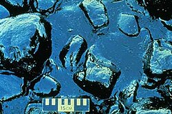
環境問題としては、1989年のエクソン・ヴァルデーズ原油流出事故が大きな教訓となり、生態系への深刻な影響を与えました。
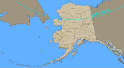
Alaska municipalities
Oil pooled on rocks on the shore of Prince William Sound after the 1989 Exxon Valdez oil spill.

エネルギー以外では、漁業が極めて重要です。特にハリバット(オヒョウ)などの魚種は、商業的にもスポーツフィッシングとしても州の経済を支えています。
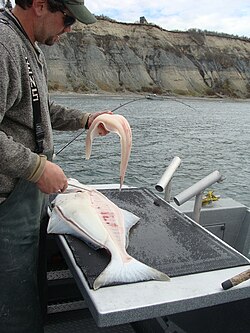
Halibut, both as a sport fish and commercially, is important to the state's economy.

社会と文化

アラスカの人口構成は多様であり、先住民の文化が色濃く残っています。イヌピアックなどの伝統的な仮面や工芸品は、今も大切に受け継がれています。
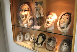
Masks on display at Iñupiat Heritage Center in Utqiaġvik

また、ロシア統治時代の名残として、シトカなどの街にはロシア正教会の聖堂が残っており、歴史的な景観を形成しています。
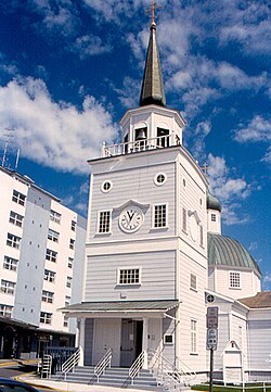
St. Michael's Russian Orthodox Cathedral in downtown Sitka

気候や地理に合わせた独自の文化として、犬ぞりレースの「アイディタロド」は州内で最も人気のある冬のイベントの一つです。
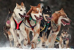
A dog team in the Iditarod Trail Sled Dog Race, arguably the most popular winter event in Alaska

スポーツ面では、アンカレッジを拠点とするチームや、大学スポーツなどが盛んです。
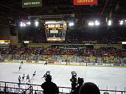
An Aces game at "The Sully"
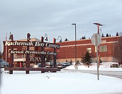
The Kachemak Bay Campus of the University of Alaska Anchorage, in downtown Homer

交通インフラについては、道路網が限られているため、フェリーや航空機が重要な移動手段となっています。
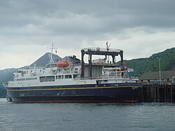
The MV Tustumena (named after Tustumena Glacier) is one of the state's many ferries, providing service to the Kenai Peninsula, Kodiak Island and the Aleutian Chain.
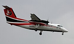
A Bombardier Dash 8, operated by Era Alaska, on approach to Ted Stevens Anchorage International Airport

政治と行政

アラスカ州の政治は、州都ジュノーにある州議会議事堂を中心に運営されています。
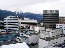
The center of state government in Juneau. The large buildings in the background are, from left to right: the Court Plaza Building (known colloquially as the "Spam Can"), the State Office Building (behind), the Alaska Office Building, the John H. Dimond State Courthouse, and the Alaska State Capitol. Many of the smaller buildings in the foreground are also occupied by state government agencies.

政治的な傾向としては、共和党の支持が強い傾向にありますが、有権者の登録状況を見ると、無所属(Unaffiliated)の割合が最も高く、独立した政治的判断を行う傾向が見られます。
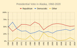
A line graph showing the presidential vote by party from 1960 to 2020 in Alaska

連邦議会においては、長年にわたりドン・ヤング議員が単独の下院議員席を49年間にわたって保持していたという特筆すべき記録があります。
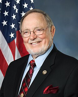
Republican Don Young held Alaska's sole U.S. House seat for 49 years, from 1973 to 2022.

アラスカ州の概要まとめ

項目 詳細
州都 ジュノー
最大都市 アンカレッジ
面積 約1,723,337 km²(全米1位)
人口(2025年推計) 737,270人
最高峰 デナリ(6,190.5m)
主要産業 石油・天然ガス、漁業、観光業
州への加入日 1959年1月3日

気候と環境

アラスカの気候は地域によって大きく異なります。南東部は海洋性気候で比較的温暖ですが、内陸部や北部は極寒の気候となります。
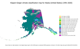
Köppen climate areas of Alaska

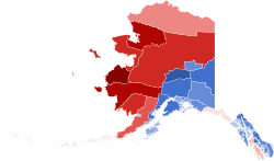
人口分布や民族構成を地図で見ると、地域によって先住民の割合が高いエリアと、白人の割合が高いエリアが明確に分かれていることがわかります。
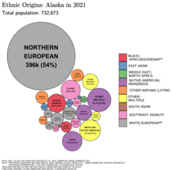
Ethnic origins in Alaska, 2021
Largest alone or in any combination ethnic origin by county in Alaska, per the 2020 census [91]
A map of the largest racial/ethnic group by borough and census area. Red indicates Native American, and blue indicates non-Hispanic white. Darker shades indicate a higher proportion of the population.

Frequently Asked Questions

アラスカ州の最大の特徴は何ですか?

全米で最大の面積を持ちながら、人口密度が最も低いという極端な地理的特徴です。また、北極圏に位置し、デナリ山のような壮大な自然と、石油産業という強力な経済基盤を併せ持っています。

州都ジュノーへの行き方は?

ジュノーは道路で結ばれていないため、他の都市から移動するには飛行機かフェリーを利用する必要があります。

アラスカの主要な産業は何ですか?

石油と天然ガスの採掘および輸出が経済的に最も重要ですが、同時にサケやハリバットなどの商業漁業も州の重要な収入源となっています。

アラスカ州はいつアメリカの一部になりましたか?

1867年にロシアから購入され領土となりましたが、正式にアメリカ合衆国の「州」として認められたのは1959年1月3日のことです。

アラスカの気候は一年中寒いのでしょうか?

地域によります。冬は極めて厳しい寒さになりますが、夏(7月頃)にはアンカレッジやフェアバンクスなどで最高気温が20度を超える日もあり、過ごしやすい季節が存在します。

References

  1. the cross the into the eastern hemisphere.
  2. These three Aleutian outer islands are about 460 miles (740 km) away from mainland USSR, 920 miles (1,480 km) from mainland Alaska, 950 miles (1,530 km) from Japan.
  3. Wally Hickel would rejoin the Republican party after winning the election as a member of the Alaskan Independence Party.
  4. , the Democratic gubernatorial nominee, suspended his campaign and became the running mate of , an independent who left the Republican Party. They won the election with 48.1% or 134,658 votes.

📸 フォトギャラリー

The Russian settlement of St. Paul's Harbor, present-day Kodiak town, Kodiak Island, 1814
Miners and prospectors climb the Chilkoot Trail during the 1898 Klondike Gold Rush.
Signing of the Alaska Treaty (1867)
U.S. troops navigate snow and ice during the Battle of Attu in May 1943.
Bob Bartlett and Ernest Gruening, Alaska's inaugural U.S. Senators, hold the 49-star U.S. Flag after the admission of Alaska as the 49th state.
Oil pooled on rocks on the shore of Prince William Sound after the 1989 Exxon Valdez oil spill.
Alaska municipalities
Alaska's size compared with the contiguous states(Albers equal-area conic projection)
Denali is the highest peak in North America.
Although entirely east of the International Date Line (the triangular kink in the line was agreed upon the U.S. acquisition of Alaska), the Aleutian Islands cross the 180th meridian, such that they contain both the westernmost (Amatignak) and the easternmost (Semisopochnoi.) points in the United States.
Anchorage is Alaska's largest city.
Fairbanks, Alaska's second-largest city and by a significant margin the largest city in Alaska's interior
Juneau, Alaska's third-largest city and its capital
Bethel, the largest city in the Unorganized Borough and in rural Alaska
Homer, showing (from bottom to top) the edge of downtown, its airport and the Spit
Utqiaġvik (Browerville neighborhood near Eben Hopson Middle School shown), known colloquially for many years by the nickname "Top of the World", is the northernmost city in the United States.
Cordova, built in the early 20th century to support the Kennecott Mines and the Copper River and Northwestern Railway, has been preserved as a fishing community since their closure.
Main Street in Talkeetna
Alaska has more acreage of public land owned by the federal government than any other state.[63]
Köppen climate areas of Alaska
Ethnic origins in Alaska, 2021
Largest alone or in any combination ethnic origin by county in Alaska, per the 2020 census [91]
A map of the largest racial/ethnic group by borough and census area. Red indicates Native American, and blue indicates non-Hispanic white. Darker shades indicate a higher proportion of the population.
St. Michael's Russian Orthodox Cathedral in downtown Sitka
An aerial view of infrastructure at the Prudhoe Bay Oil Field
The Trans-Alaska Pipeline transports oil, Alaska's most financially important export, from the North Slope to Valdez. The heat pipes in the column mounts are pertinent, since they disperse heat upwards and prevent melting of permafrost.
Alaska proven oil reserves peaked in 1973 and have declined more than 60% since then.
Alaskan oil production peaked in 1988 and has declined more than 75% since then.
Halibut, both as a sport fish and commercially, is important to the state's economy.
Masks on display at Iñupiat Heritage Center in Utqiaġvik
A dog team in the Iditarod Trail Sled Dog Race, arguably the most popular winter event in Alaska
An Aces game at "The Sully"
The Kachemak Bay Campus of the University of Alaska Anchorage, in downtown Homer
The MV Tustumena (named after Tustumena Glacier) is one of the state's many ferries, providing service to the Kenai Peninsula, Kodiak Island and the Aleutian Chain.
A Bombardier Dash 8, operated by Era Alaska, on approach to Ted Stevens Anchorage International Airport
The center of state government in Juneau. The large buildings in the background are, from left to right: the Court Plaza Building (known colloquially as the "Spam Can"), the State Office Building (behind), the Alaska Office Building, the John H. Dimond State Courthouse, and the Alaska State Capitol. Many of the smaller buildings in the foreground are also occupied by state government agencies.
A line graph showing the presidential vote by party from 1960 to 2020 in Alaska
Republican Don Young held Alaska's sole U.S. House seat for 49 years, from 1973 to 2022.